Barrick Bullfrog Gold Mine
Beatty, Nevada
36.8794°N 116.8539°W
36.8794°N 116.8539°W
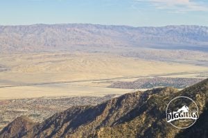
The Barrick Bullfrog Gold Mine, located in Beatty, Nevada, is situated in the Bullfrog-Pioneer Mining District, which is now part of the Death Valley Wilderness. This mine utilizes both surface and underground mining techniques. The mined ore is a mixture of chalcocite, cerargyrite, and limonite, while the waste material primarily consists of alunite, quartz, and calcite. The ore body itself is described as having a tabular shape, although its dimensions are currently unknown. The rock formation associated with this area is Neogene basalt, which was formed approximately between 23.03 and 2.58 million years ago.
Site identification and general characteristics. Learn about USGS mines.
Click to open an interactive map.
© The Diggings™
Additional textual information about a site or mine.
OXIDE ORE CONTAINS NATIVE GOLD, CERARGYRITE, LIMONITE, CHALCOCITE, GALENA AND CRUSTIFIED AND PORCELANEOUS CALCITE.
LOCATION APPROXIMATE-TO NEAR CENTER OF SECTION 20; INFO FROM LAND. ST :1972.
THE MINE IS LOCATED JUST EAST OF THE HISTORIC GHOST TOWN OF RHYOLITE CENTERED ROUGHLY BETWEEN LADD, PARADISE, AND MONTGOMERY MOUNTAINS.
Formal or informal mining district names.
THIS NEW RECORD DESCRIBES SPECIFICALLY THE MOST RECENT BULLFROG GOLD MINE OPERATED BY BARRICK GOLD, WHICH ENCOMPASSES SEVERAL OLDER HISTORIC GOLD MINES IN THE DISTRICT, INCLUDING M242413, M231918, AND W002909, FROM WHICH ALL PERTINENT MATERIAL HAS BEEN INCORPORATED INTO THIS NEW RECORD. THE EARLIER RECORDS SHOULD NOT HOWEVER BE DELETED FROM THE DATABASE FOR HISTORIC REFERENCE.
LISTED AS AN ACTIVE MINE, MILL, HEAP LEACH OPERATION IN 1983, EMPLOYING 12 WORKERS.
THE BARRICK BULLFROG GOLD MINE WON THE NEVADA EXCELLENCE IN MINE RECLAMATION AWARD IN BOTH 1996 AND 2000 FOR RECLAMATION AND POST-MINING LAND USE. IN 2004 IT WAS REPORTED THAT BARRICK CORP. INTENDS TO TRANSFER 81 ACRES OF ITS FORMER MINING PROPERTY TO THE BEATTY ECONOMIC DEVELOPMENT CORPORATION, A 501 (C) 3 NON-PROFIT. THE REDEVELOPMENT PLAN PROPOSES THE LAND'S USE AS A WIND AND SOLAR FARM, A DEMONSTRATION PROJECT FOR GREEN ENERGY.
MINE AND MILL, HEAP LEACH OPERATION
THE BARRICK BULLFROG MINE WAS FIRST DEVELOPED BY OPEN PIT METHODS, BUT AS MINING PROGRESSED DEEPER, UNDERGROUND METHODS WRE USED TO MINE DEEPER HIGH GRADE TABULAR FEEDER ZONES. ADITS WERE COLLARED AT DIFFERENT LEVELS WITHIN THE OPEN PIT.
Processes that concentrated or enriched the mineralization of the mine.
BEFORE MINING BEGAN IN 1989, RESERVES OF 18. 6 MILLION TONS OF ORE GRADING 0. 097 OOUNCES OF GOLD PER TON WERE REPORTED. BY 1996, THERE WAS 10. 2 MILLION TONS GRADING 0. 062 OPT GOLD AS PROVEN AND PROBABLE RESERVES; PLUS 3. 7 MILLION TONS GRADING 0. 040 OPT GOLD IN MINERALIZED MATERIAL. FROM 1989 THROUGH 1999, THE BARRICK BULLFROG MINE PRODUCED A TOTAL OF 2, 313, 643 OUNCES OF GOLD AND 3, 026, 451 OUNCES OF SILVER.
VOLCANICS IN THE MINE VICINITY ARE BROKEN INTO BLOCKS THAT DIP 40 DEG EAST. FAULTS TREND NW_NE, DIP W WITH NORMAL DISPLACEMENT. FAULTING IS POSSIBLY SAME AGE AS VOLCANICS. FAULT BLOCKS HAVE BEEN ROTATED WITH HORIZONTAL MOVEMENT LESS THAN VERTICAL.
Characteristics of the ore body.
Geological materials at the site.
Geologic structural features affecting or characterizing the site or mine.
Tectonic setting in which the site or deposit is situated.
Mineralogical and chemical alteration at or near the site, which may help to indicate the geographic extent of the geological processes producing the mine.
Controls on emplacement of ore such as faults or other structural features.
Other deposits in the same region.
Tecopa Consolidated
Tramps Gold Mine
Denver Gold Mine
Denver Gold Mine
Tramps Consolidated Mine
Virginia Lode Claim
Virginia Lode Claim
National Bank Mine
S. And Kk Mine
Ms Claims
* Mine bounds on map indicate the general area that a mine occupies. For an detailed map, refer to the overseeing BLM field office.
** The mine central point is based on an average of the mine's bounding box(es) and does not necessarily fall on the claim itself.
1 World-class significance is determined by total endowment of the contained commodity. This includes all past production and remaining reserves. Each commodity is considered separately and commodities cannot be combined to arrive at a significant size. The tonnage thresholds are from the mine model grade-tonnage studies. As of June 2008, many entries were classified as significant under less strict rules.
Learn more about the Bureau of Land Management, Public Land Survey System, and mining claims.

Understanding Claim Ownership
We receive lots of emails from people who find their name or a relative’s name on our site and want to know if this means they have some right to the land listed under that name.
Understanding BLM Administrative Areas
Whether it is filing a mine or researching one, the administering BLM office is going to be the definitive source.

Understanding Location Data
Mine handled by the Bureau of Land Management are not mapped by latitude and longitude, instead, these mines harken back to the Public Land Survey System.
Understanding Townships
A “township” can refer to two different things. Both are part of the PLSS measurement system but have different uses.
Notes
ORE MATERIALS: AURIFEROUS PYRITE, NATIVE GOLD, CERARGYRITE, LIMONITE, CHALCOCITE, GALENA.
GANGUE MATERIALS: QUARTZ, CALCITE, LIMONITE, ALUNITE.